Lüderitz
 |
The town is known for its colonial architecture, including some Art Nouveau work, and for wildlife including seals, penguins, flamingos and ostriches. It is also home to a museum, and lies at the end of a decommissioned railway line to Keetmanshoop. The town is named after Adolf Lüderitz, founder of the German South West Africa colony.
The centre of Lüderitz' economic activity is the port, until the incorporation of the exclave Walvis Bay in 1994 the only suitable harbour on Namibia's coast. However, the harbour at Lüderitz has a comparatively shallow rock bottom, making it unusable for many modern ships. The recent addition of a new quay has allowed larger fishing vessels to dock at Lüderitz. The town has also re-styled itself in an attempt to lure tourists to the area, which includes a new waterfront area for shops and offices.
Lüderitz is situated on the B4 national road to Keetmanshoop. It is also the terminus of the 318 km railway line to Seeheim where the railway connects to the rest of the country's network. This line, built by inmates of the concentration camp on Shark Island, was completed in 1908 but is currently not operational. Rebuilding of a remaining 47 km track gap to Aus has been delayed since 2009.
Construction of a new port at Shearwater Bay, 30 km south of Lüderitz, has been proposed for the export of coal from Botswana with a 1,600 km railway connecting the two.
Map - Lüderitz
Map
Country - Namibia
 |
 |
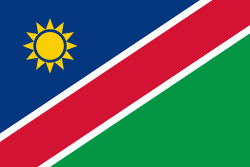
| Flag of Namibia | |
The driest country in sub-Saharan Africa, Namibia has been inhabited since pre-historic times by the San, Damara and Nama people. Around the 14th century, immigrating Bantu peoples arrived as part of the Bantu expansion. Since then, the Bantu groups, the largest being the Ovambo, have dominated the population of the country; since the late 19th century, they have constituted a majority. Today Namibia is one of the least densely populated countries in the world.
Currency / Language
| ISO | Currency | Symbol | Significant figures |
|---|---|---|---|
| NAD | Namibian dollar | $ | 2 |
| ZAR | South African rand | Rs | 2 |
| ISO | Language |
|---|---|
| AF | Afrikaans language |
| EN | English language |
| DE | German language |
| HZ | Herero language |


